
It was a rather cold weekend here in the Northeast as temperatures Saturday morning dipped into the single digits and even below zero in a few isolated spots. This was followed by some snow on Sunday, but mainly from New York City to Boston. There is another disturbance that will move across the I-95 corridor Monday night, but with marginal temperatures and the light variety of precipitation, not much snow accumulation is anticipated. Here is a look at the simulated radar for 1 AM Tuesday.
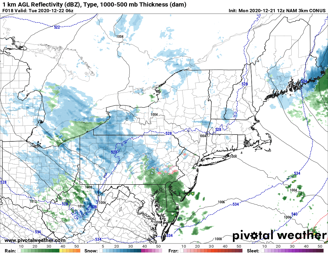
Courtesy Pivotal Weather
Once that system exits early Tuesday morning, the weather looks rather quiet through Wednesday. There could be a few flurries for interior locations of the Northeast, but they won't cause any issues. Temperatures Tuesday and Wednesday will be seasonable with highs both days in the 30s to low 40s.
That brings us to Christmas Eve. Thursday starts off dry, but the chance for rain will increase through the day from west to east as a strong cold front pushes towards the Eastern Seaboard. Ahead of the front, temperatures will climb well above normal on the heels of a gusty south wind. Take a look at forecast temperatures for 5 PM on Christmas Eve.
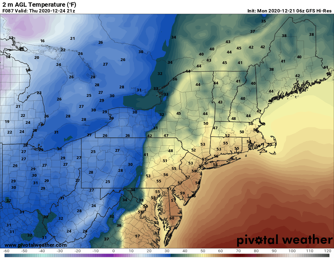
Courtesy Pivotal Weather
And although it will be very mild for late December, heavy rainfall will accompany the approach and passage of the cold front as we progress into Christmas morning. Flooding will become a concern from Boston to Washington, DC and especially in those areas that still have a healthy snowpack from last week's Nor'easter. Here is a look to total rainfall expected Christmas Eve through Christmas Day.
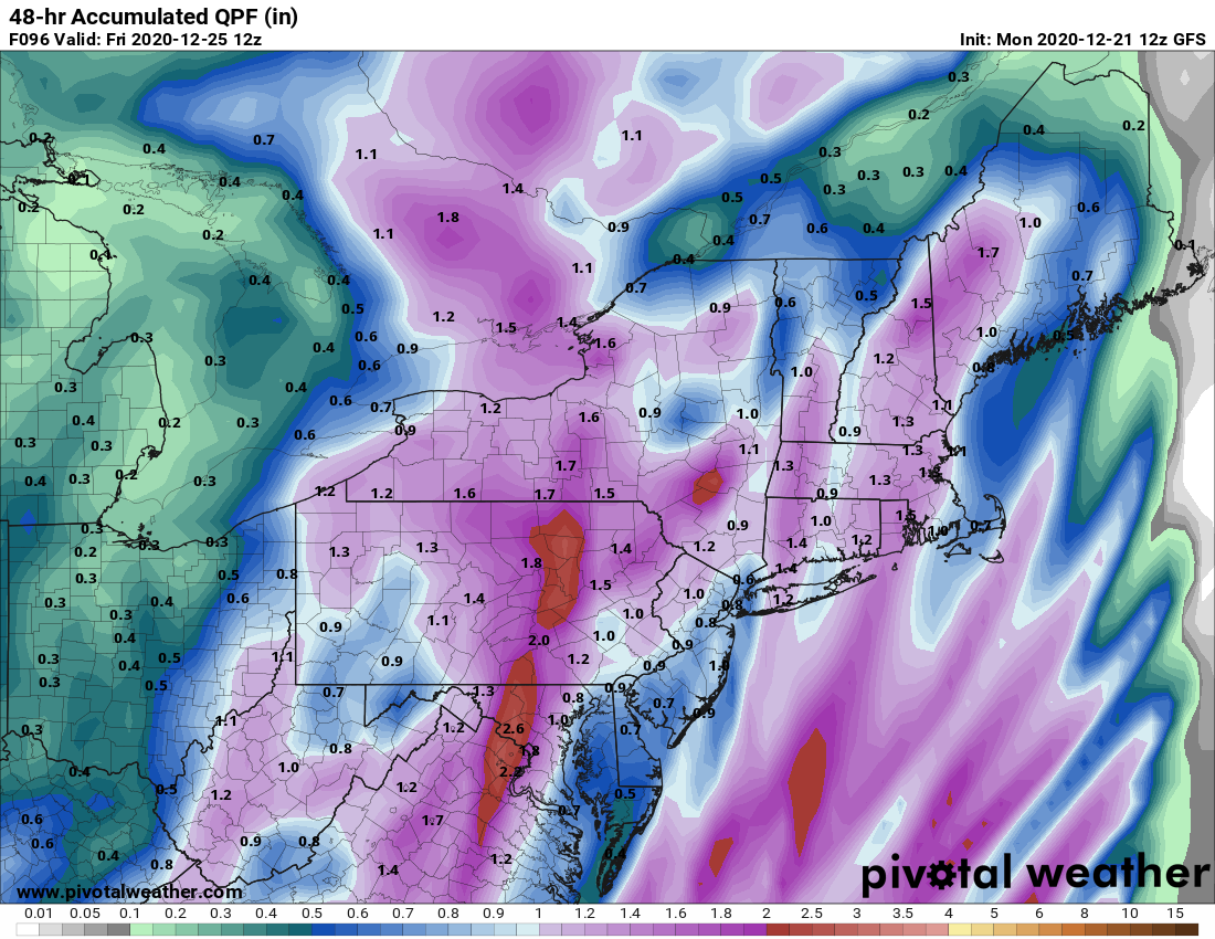
Courtesy Pivotal Weather
Also, it will become very windy Christmas Eve night into Christmas morning. Gusts over 50 mph will be possible and there could even be a few rumbles of thunder. Definitely more like spring than winter. But, cold air will quickly rush in behind the front and we may see the rain change to snow across the interior Northeast with perhaps some accumulation. However, the rain exits a bit too fast along the I-95 corridor, so a changover to snow is unlikely for the big cities. Either way, it will be an adventurous and eventful ride for Santa this year up and down the Eastern Seaboard on Christmas Eve. Have a great holiday season everyone and Merry Chrsitmas !!


